An appraiser needs to analyze what is physically possible for a property. GIS is a software tool which can help an appraiser view, understand, interpret, and share data in many ways. The GIS data helps the appraiser understand a property's physical characteristics and overall utility by layering visual data together. This is especially important for undeveloped land or developed parcels with excess land.
By looking at a high definition satellite image of the property along with the visual GIS data, the appraiser can analyze the usable land size of a parcel. This is an important tool in the appraisal process as land is most often compared on a price per usable area basis. Although GIS data is relatively accurate, this process is not meant to be a substitute for more detailed engineering, planning, or surveys. There are many other scenarios where GIS is useful.
Some of the data which can be utilized by a Geographical Information System includes:
• Town Tax Maps (Parcels) •Utilities
•Assessors Information •Municipal Water Service Area
•Zoning Map •Municipal Sewer Service Area
•FEMA Flood Zones •Streams / Rivers
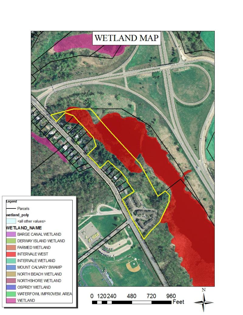
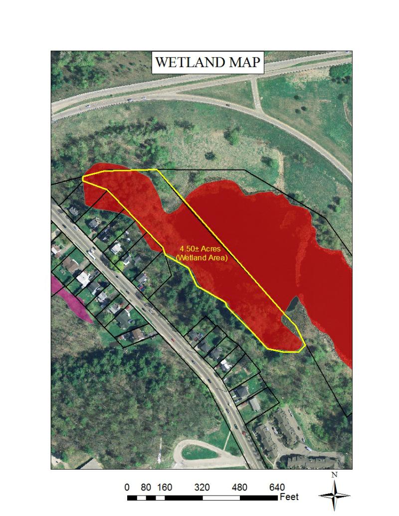
•Wetlands •Geologic Hazards
•Topography •Mineral Resources
•USDA Soil Map •Demographical Information
•Septic Suitability

Champlain Valley Appraisal Services, PLLC
Brett Schermerhorn
Phone: 802-881-0622
There are an abundance of resources available which can be utilized for valuation purposes. I have included a few links on the Resources section of my website which serves as an example.

In addition to traditional methods of sale confirmation, GIS can help provide further detail of property characteristics. The appraiser can then prepare a sale map for the user of the report which will help convey understanding of the comparable sale used. A geographical information system helps solve problems by looking at data in a way that is quickly understood and easily shared. The following exhibits are examples of what you would see in an appraisal report.
Geographical Information System (GIS) For Real Estate Appraisal